Industry Portal
Related News
- 00
0000-00
How Does a Smart LED Headlight System Adapt to Oncoming Traffic? - 00
0000-00
Smart Tire Growth Shifts to Integrated Sensors as Tire Makers Gain Pricing Power - 00
0000-00
Headlight Assembly Price: OEM vs Aftermarket Costs and Buying Factors - 00
0000-00
Japan Auto and Parts Associations Advance Common Parts Standards - 00
0000-00
How Optical Perception in ADAS Detects Lanes and Obstacles
How Optical Perception in ADAS Detects Lanes and Obstacles
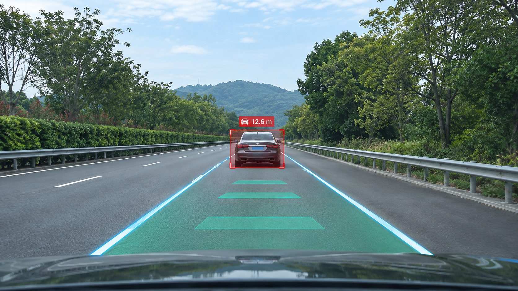
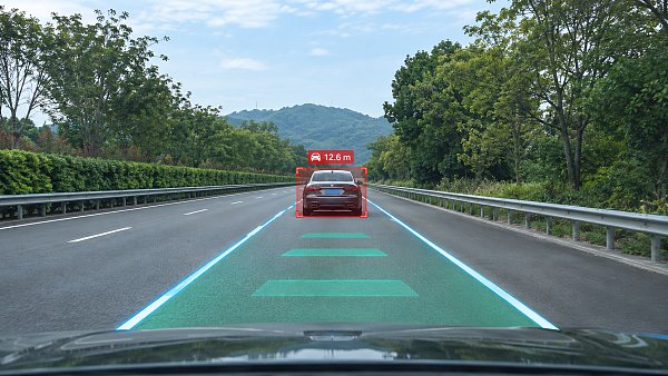
Smart optical perception for ADAS detects lanes and obstacles by converting camera images into estimates of road boundaries, object positions, and their movement relative to the vehicle. The safety value of those estimates depends on more than whether a lane line or pedestrian is visible in a single frame: the system must also know when its view is degraded, maintain consistent geometry over time, and deliver information early enough for the driving function to respond.
A useful technical assessment therefore connects image quality, perception output, vehicle integration, and scenario-based testing. A detector that performs well on clear, straight roads may behave very differently at a crest, through windshield glare, or when a pedestrian emerges from behind a parked vehicle.
From camera exposure to a road model
An automotive camera captures light reflected from the scene through a lens and protective surfaces, often including the windshield. The sensor converts that light into electrical signals, which pass through an image signal processing pipeline. Exposure control, noise reduction, color processing, and contrast adjustment influence the features available to downstream perception models. Excessive noise reduction, for example, can smooth away faint lane markings, while aggressive contrast processing can obscure detail in bright or dark regions.
The perception pipeline interprets the resulting images using algorithms trained or designed to recognize visual patterns. Lane detection may identify marking pixels, boundaries, or a parameterized lane shape. Obstacle detection estimates object classes and image locations; tracking associates detections across successive frames. These outputs are then transformed into a vehicle-referenced representation used by functions such as lane departure warning, lane keeping assistance, or automatic emergency braking.
The transformation relies on camera calibration. Lens distortion, mounting position, and orientation affect the relationship between image coordinates and the road. A small error in camera pitch can shift the estimated position of a distant lane boundary substantially because distant road features occupy a narrow region of the image. Vehicle loading, suspension motion, a replaced windshield, or a disturbed camera bracket can change the effective geometry and warrant attention in calibration and service procedures.
Lane detection: geometry is as important as classification
Lane perception begins with visual evidence such as painted lines, road edges, curbs, and surface texture. A system may segment the image into relevant regions and then fit curves or infer lane boundaries in a ground-plane representation. The result is often expressed as a lateral offset, heading difference, curvature, and a distance over which the estimate remains valid.
Those outputs serve different purposes. A visually convincing curve extending far ahead is of limited value if the markings supporting it disappear after a short distance. Reporting the visible or supported range alongside the curve helps distinguish observed geometry from extrapolation. Confidence also needs interpretation: a high model score does not by itself establish that the estimated boundary is physically correct under a new road condition.
Several scene changes complicate the definition of a lane. At roadworks, temporary markings may cross old paint or run beside removed markings that still leave visible traces. At a merge, the number and topology of boundaries change; forcing the scene into a fixed pair of parallel lines can produce an unstable lane center. Snow, standing water, and shadows create a different problem: the system must decide whether it has enough evidence to continue tracking a boundary rather than treating every high-contrast edge as paint.
Temporal filtering reduces frame-to-frame jitter, but it introduces a trade-off. Strong smoothing can make a boundary appear stable while delaying the response to a genuine lane change or a sharp change in curvature. The appropriate behavior depends on the downstream function and vehicle speed, so lane accuracy should be assessed together with latency and the rate at which the estimate adapts.
Obstacle detection: identifying an object is only the first step
Object detection typically produces a class, a location in the image, and a confidence score. A tracker combines observations across frames to estimate persistence and motion. The resulting track may represent a vehicle, cyclist, pedestrian, or another obstacle relevant to the driving function. Occlusion handling matters because an object can disappear briefly behind another vehicle and reappear in a different image position.
A bounding box alone does not tell the vehicle how far away an object is. A monocular camera has to infer distance from cues such as apparent size, road geometry, object motion, and learned features. These estimates become uncertain when the object's true dimensions are unusual, its contact point with the road is hidden, or the road surface departs from the assumed geometry. Stereo cameras obtain depth from the displacement between synchronized views, but their usable detail also depends on calibration, scene texture, and the geometry of the camera pair.
Distance and relative speed together affect collision assessment. A small distance error can change the estimated time available to respond, particularly when closing speed is high. Relative motion is also difficult to infer reliably during sudden braking, ego-vehicle turns, or partial occlusion. A perception output should therefore be examined for track age, update rate, position uncertainty, and delay, not simply the presence of the correct object label.
False positives and missed detections have different consequences. A shadow or overhead structure interpreted as a road obstacle can trigger unnecessary braking; a stationary object missed in the vehicle path can leave too little time for intervention. Adjusting a detection threshold changes the balance between these outcomes, so an isolated accuracy figure cannot describe suitability for a braking function.
Light, weather, and the limits of visible evidence
Glare can saturate parts of an image and remove detail needed to distinguish a lane marking or object. A low sun, headlights from oncoming traffic, and reflections from wet pavement create different spatial patterns, even though all can reduce contrast. High dynamic range capture helps preserve information across bright and dark areas, but it cannot reconstruct detail that never reaches the sensor or is lost through severe saturation.
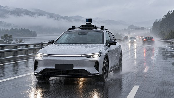
Rain affects perception in several ways at once. Water on the road changes reflections and obscures paint; droplets on the windshield distort or block local image regions; spray from other vehicles reduces contrast over a larger area. A wiper can clear part of the view while temporarily crossing the camera image. These effects should be separated during testing because a model improvement for wet-road reflections will not necessarily correct an obstructed optical path.
Night scenes introduce their own dependencies. Headlights illuminate only part of the road, and their beam pattern affects how much usable contrast reaches the camera. An adaptive beam may change the illuminated region as traffic moves. Exposure transitions when entering a tunnel or passing through alternating light and shade can also cause temporary loss of detail. Testing the camera and lighting behavior together reveals interactions that component-level image quality measurements can miss.
Dirt, ice, condensation, lens damage, and windshield films can degrade the image without producing a complete camera failure. A blocked-camera monitor should be assessed for both detection and response: how much of the relevant field of view is obscured, how long the condition persists, and whether the driving function changes state or informs the driver when reliable perception is unavailable.
Connecting perception to vehicle behavior
Camera perception rarely acts in isolation. Radar, where fitted, can supply range and relative velocity information that complements visual classification, while vehicle motion sensors support compensation for steering, yaw, and speed. Fusion requires measurements to be aligned in time and expressed in compatible coordinate systems. An accurate camera detection paired with a delayed or incorrectly transformed radar measurement can still produce a misleading combined track.
Sensor agreement is not guaranteed. A camera may identify a pedestrian whose radar return is weak, while radar may report a target that is difficult to classify visually. The fusion logic must handle uncertain and conflicting evidence in a way that fits the intended function. Requiring every sensor to agree could suppress a real hazard; accepting every unsupported detection could increase nuisance interventions.
Latency should be measured across the complete chain: exposure, image transfer, processing, tracking, fusion, and delivery to the control function. Frame rate alone does not establish response time. A pipeline can process images frequently while using old frames or accumulating delay in buffering. Timestamped measurements under representative computing load reveal whether the information reaching the controller is current enough for the intended maneuver.
Evidence that makes performance claims meaningful
Perception results need a defined operating context: road type, speed range, lighting, weather, camera configuration, and the function that consumes the output. Test scenarios should include ordinary driving as well as conditions near the stated limits. A lane-keeping system intended for marked highways, for example, should be assessed differently from a function expected to interpret complex urban junctions.
For lanes, useful measurements include lateral and heading error against a reference, the range over which the boundary is supported, detection continuity, and the delay in recognizing a boundary change. Results should be broken down by marking condition, curvature, lighting, and occlusion. A single average can conceal a systematic failure on worn markings or in low-angle sunlight.
For obstacles, the evaluation should distinguish missed objects, false detections, classification errors, position and velocity errors, and track interruptions. Results become more informative when grouped by object type, distance, relative motion, and visibility. A pedestrian partly hidden by a parked vehicle poses a different perception problem from a fully visible pedestrian crossing an empty road.
Reference data also has limits. Image annotations can disagree about the precise boundary of an occluded object or the endpoint of faded paint. Ground-truth measurements need appropriate spatial and timing accuracy, and the treatment of ambiguous cases should be documented. Otherwise, apparent changes in model performance can arise from labeling or synchronization differences rather than from a better perception system.
Standards-related evidence is most useful when it identifies the applicable edition, the function and operating conditions covered, the test method, and any exclusions. Functional safety, intended-function limitations, and vehicle-level test requirements address different aspects of the problem; compliance evidence for one aspect does not establish detection performance across every scene. Changes to camera hardware, image processing, mounting, or model software also call for impact assessment and targeted regression testing because each can alter the visual evidence on which the system depends.
Have questions about this sector analysis, or seeking best practices specific to your niche? Drop us a line below and let the senior consultants at AEVS assist you.
Related News
 Latest Sector NewsJapan Auto and Parts Associations Advance Common Parts StandardsJapan automotive parts standards could reshape sourcing for iron, resin and wiring. Explore the proposed initiative and what suppliers should watch.MORE+
 Latest Sector NewsHow Optical Perception in ADAS Detects Lanes and ObstaclesDiscover how smart optical perception for ADAS detects lanes and obstacles, and explore the factors that shape accuracy, response time, and real-world safety.MORE+
 Latest Sector NewsVehicle Chassis Lightweighting: Comparing Steel, Aluminum and CompositesExplore vehicle lightweighting solutions for chassis design. Compare steel, aluminum and composites to balance mass, durability, cost and production needs.MORE+
 Latest Sector NewsVehicle Exterior Design Surfacing: From Concept Sketch to Class-A ModelVehicle exterior design surfacing turns sketches into Class-A models. Explore the workflow, surface quality checks, and engineering decisions behind production-ready designs.MORE+
 Latest Sector NewsChoosing OEM-Quality Replacement Tires: Size, Load and Speed RatingsFind replacement tires OEM quality shoppers can trust. Learn how to match tire size, load index, and speed rating to your vehicle and driving needs.MORE+
 Latest Sector NewsChina Seeks Input on Vehicle Modification Rules, Including Wheel and Tire RegistrationChina's proposed vehicle modification rules could require wheel and tire change registration. Discover what the draft means for owners and aftermarket businesses.MORE+
 Latest Sector NewsChina’s NEV Export Surge Opens Opportunities for Quiet Tire SuppliersChina’s NEV export surge creates potential opportunities for quiet tire suppliers. Explore the role of grip, sourcing decisions and trade measures.MORE+
 Latest Sector NewsChoosing a Photoelectric Sensor OEM Supplier: Quality and Lead TimeChoose a photoelectric sensors OEM supplier with confidence. Compare quality controls, lead times and total costs to reduce supply risks and protect production.MORE+
 Latest Sector NewsNatural Rubber Prices Fluctuate as Chinese Tire Buying Provides SupportNatural rubber prices face supply pressure as Chinese tire buying provides support. Explore the latest market trends and what they mean for buyers.MORE+
 Latest Sector NewsVehicle Lightweighting Materials: Comparing Steel, Aluminum and CompositesCompare vehicle lightweighting materials, including steel, aluminum and composites, to find the right balance of mass, cost, durability and manufacturing.MORE+
 Latest Sector NewsVehicle Lightweighting Solutions: Balancing Weight, Safety and PerformanceExplore vehicle lightweighting solutions performance, compare materials and manufacturing options, and discover how to balance weight savings with safety, durability and cost.MORE+
 Latest Sector NewsMichelin Showcases 75% Renewable-Material Tire and Touch Intelligence at CIIEMichelin showcases a 75% renewable-material tire and Touch Intelligence at CIIE. Discover how these innovations aim to address EV performance and sustainability.MORE+
 Latest Sector NewsEU Launches Safeguard Investigation Into Hybrid Vehicle ImportsEU hybrid vehicle import investigation: explore potential safeguard measures, implications for exporters and what to watch in official updates.MORE+
 Latest Sector NewsChoosing 19-Inch Low-Pressure Cast Wheels: Fitment, Load Rating and WeightChoosing 19 inch low pressure cast wheels? Learn how to check fitment, load ratings, brake clearance and weight before you buy.MORE+
 Latest Sector NewsUSTMA 2025 Scrap Tire Report: 79% Reached End-Use MarketsUSTMA 2025 Scrap Tire Report: 79% reached end-use markets. Explore what shifting recycling demand, rising exports and stockpile cleanup mean for the industry.MORE+
 Latest Sector NewsBeam vs. Conventional Wiper Blades: Is the Upgrade Worth It for Your Car?Are beam auto wipers worth the upgrade? Compare winter performance, highway visibility, fitment, and cost with conventional blades to find the right choice for your car.MORE+
 Latest Sector NewsNinth CIIE Welcomes First Exhibits, Michelin Sustainable Tire Set for Asian DebutMichelin’s sustainable tire, made with 75% renewable and recycled materials, is set for its Asian debut at the ninth CIIE. Explore key material claims and what buyers should verify.MORE+
 Latest Sector NewsNHTSA Proposes FMVSS 108 Update for Automated Vehicle LightingExplore NHTSA’s proposed FMVSS 108 update for automated vehicle lighting and discover what greater design flexibility could mean for ADS developers and lighting suppliers.MORE+
 Latest Sector NewsReplacement Headlight Assemblies for Sedans: Fitment Checks Before You BuyBuying a headlight assembly for sedans? Check VIN fitment, lighting technology, connectors, and beam patterns before you order. Avoid costly returns with our practical buying guide.MORE+
 Latest Sector NewsPirelli and BKT Reach Agreement to Enter India's Passenger Car Tyre MarketPirelli and BKT plan passenger car tyre production in India, targeting up to 800,000 tyres by 2030. Explore what the deal could mean for buyers, suppliers and premium tyre sourcing.MORE+
 Latest Sector News2026 NEV Exterior Compliance: Key Standards for EU and China Market AccessWhich exterior standards matter most for the NEV industry in 2026? Explore EU and China rules for lighting, glazing, tires and more to close compliance gaps and plan market access.MORE+
 Latest Sector NewsTire Makers Face Profit Pressure as Raw Material Costs Outpace Price HikesTire makers face profit pressure as raw material costs outpace 2%–5% price hikes. Discover why higher tire prices may not translate into stronger margins.MORE+
 Latest Sector NewsECE-Compliant Fog Lamps: Which Approval Marks and Test Reports Should You Check?Evaluating ECE compliant lighting fog lamps? Learn which E-marks, UN approvals and test reports to check, avoid costly compliance gaps and qualify suppliers with confidence.MORE+
 Latest Sector NewsVehicle Perception System Accuracy: Which Metrics Matter in Rain and Fog?Compare vehicle perception systems accuracy in rain and fog. Discover the recall, tracking, and latency metrics that expose hidden risks and help you choose a more reliable system.MORE+
 Latest Sector NewsECE-Compliant Lighting for Commercial Vehicles: Approval and Installation ChecksExplore ECE compliant lighting commercial vehicles can rely on. Learn key approval, installation, aiming and wiring checks to reduce compliance risks before release.MORE+
 Latest Sector NewsNEV Industry Standards in China: Which Battery Safety Tests Are Required?Explore NEV industry standards in China, required battery safety tests, and GB 38031 updates. Learn how to verify compliance evidence and prepare for confident market-entry decisions.MORE+
 Latest Sector NewsAutomotive Exterior Lighting Systems: Lamp Types, Functions, and PlacementExplore the automotive exterior lighting system: lamp types, functions, and placement. Learn key differences, spot common issues, and make smarter lighting replacement choices.MORE+
 Latest Sector NewsWhere exterior systems engineering prevents late-stage automotive reworkExterior systems engineering automotive insights reveal how integrated reviews of wheels, lighting, roofs, and sensors prevent costly late-stage rework.MORE+
 Latest Sector News2026 urban bumper trends focus on low-speed impact resistanceUrban vehicle bumper design trends 2026 impact resistance: explore smarter materials, sensor protection, repairability, and low-speed resilience for city vehicles.MORE+
 Latest Sector NewsHow to Evaluate an Automotive Exterior Systems Manufacturer for OEM Program SupplyAutomotive exterior systems manufacturer evaluation guide for OEM programs—assess engineering, quality, compliance, supply resilience, and total lifecycle risk.MORE+
 Latest Sector NewsSelecting NEV Exterior Components for Aerodynamics, Durability, and EV IntegrationNEV exterior components selection guide: balance aerodynamics, durability, NVH, smart lighting, sensors, and EV integration for reliable vehicle performance.MORE+
 Latest Sector NewsSupplier Capability Evaluation Matrix: Criteria and Weighting for Reliable SourcingSupplier capability evaluation matrix guide: build weighted, evidence-based criteria for quality, compliance, capacity, delivery resilience, and cost control.MORE+
 Latest Sector NewsHow to Select NVH Control Materials for Automotive Panels and Powertrain SystemsNVH control materials for automotive panels and powertrain systems: learn how to balance damping, absorption, barriers, durability, and weight for a quieter vehicle.MORE+
 Latest Sector NewsHow to Evaluate a Photoelectric Sensing Supplier for Industrial Automation ProjectsChoose the right photoelectric sensing supplier for industrial automation. Compare technical fit, lifecycle cost, support, quality control, and supply reliability.MORE+
 Latest Sector NewsDOT-Compliant Truck Lighting: A Practical Guide to FMVSS 108 RequirementsDOT compliant truck lighting guide: understand FMVSS 108 requirements, LED replacements, lamp placement, conspicuity tape, and practical inspection steps.MORE+
 Latest Sector NewsOptical Sensing Systems in Europe: Key Selection Criteria for Industrial BuyersOptical sensing systems Europe: learn how industrial buyers compare accuracy, integration, durability, and lifecycle support to choose reliable solutions that reduce downtime.MORE+
 Latest Sector NewsWhat Smart Mobility Europe Means for Urban Fleets and EV Infrastructure PlanningSmart mobility Europe is reshaping urban fleets and EV infrastructure planning with smarter charging, fleet design, and scalable operations.MORE+
 Latest Sector NewsHow Automotive Sensor Systems Improve ADAS Performance and Vehicle SafetyAutomotive sensor systems improve ADAS with better detection, sensor fusion, and safer real-world driving. Learn how they enhance vehicle safety, lighting, and NEV performance.MORE+
 Latest Sector NewsAutomotive Sensor Systems and ISO 26262: What to Review for Functional Safety ComplianceAutomotive sensor systems ISO 26262 review: learn what to check for functional safety compliance, key failure risks, validation gaps, and practical sign-off steps for safer vehicle sensor integration.MORE+
 Latest Sector NewsPhotoelectric Sensors Supplier Selection: Key Sensing Range and Output FactorsPhotoelectric sensors supplier selection starts with real sensing range and output fit. Learn how to compare reliability, integration, and durability for smarter, lower-risk system performance.MORE+